
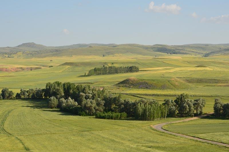
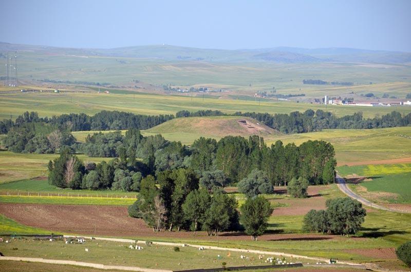
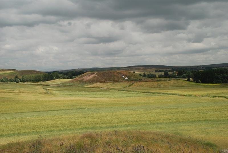
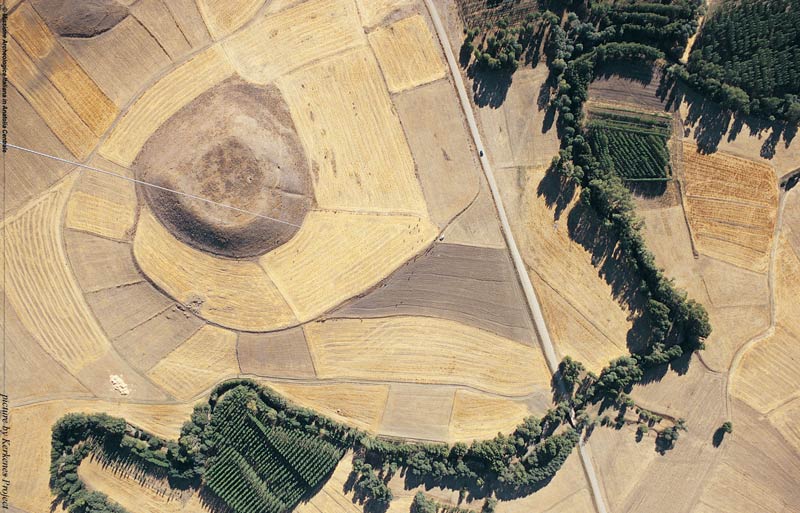
The Site
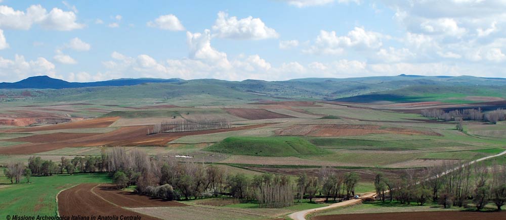
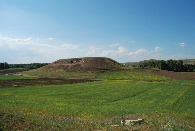
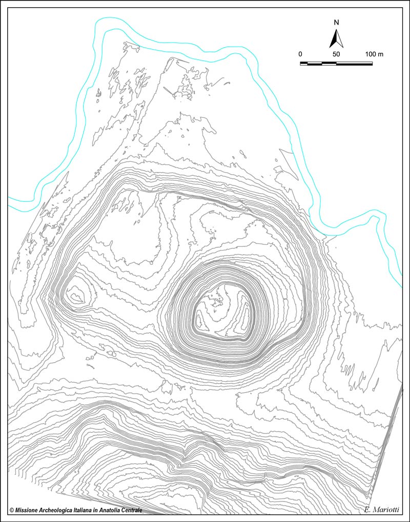
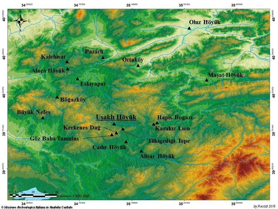
The site, known by different names (Kusachakly, Kuşaklı, Uçaklı) and recorded in the land registry of Sorgun as Uşaklı Höyük, lies on a plain crossed by the Eğri Öz Dere, a tributary of the Kanak Su and dominated by the granite mass of Kerkenes Dağ. Consisting of a flat, ovoidal terrace covering an area of 10 hectares and a small mound of 2 hectares, it is clearly visible from the plain and from the road which links Yozgat with Sivas.
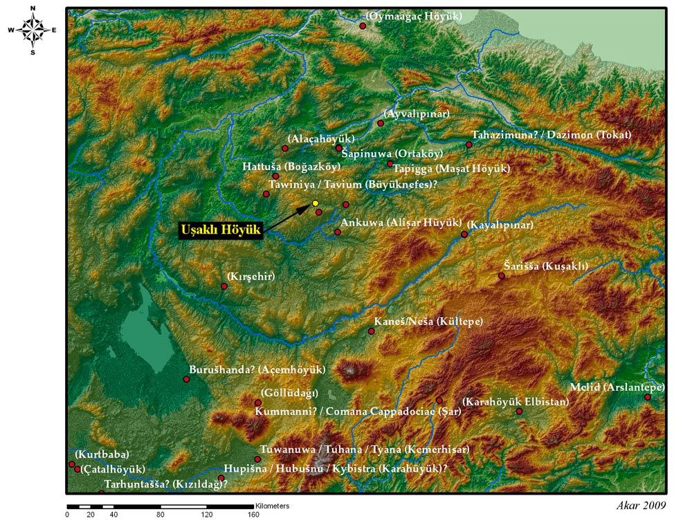
The position, size and presence of large granite blocks on the surface had already suggested that the site be associated with an important Hittite city, a centre of the cult of the Storm God which lay two days’ walk away from the capital, Hattuša. In fact, the text of the Spring Festival (AN.TAH.ŠUM) records the journey of the king from the capital to Zippalanda and Mount Daha, where he performs a rite before continuing on to the city of Ankuwa, identified with the site of Alişar Höyük. Uşaklı Höyük lies exactly half-way between this latter centre and Hattuša, and the imposing Kerkenes Dağ which looms on the town’s southern horizon corresponds exactly with the position of Mount Daha as given in the written sources.
The surface survey campaigns (2008-2012) and excavations (2013-2015) not only confirm the importance of this site during the Hittite period, but have also yielded new documentations regarding its long period of existence from the end of the Late Bronze Age (end of the 3rd millennium B.C.), through the Middle Bronze Age (first half of the 2nd millennium B.C.), Late Bronze Age (second half of the 2nd millennium B.C.), the Iron Age (10th - 6th centuries B.C.) to the late Roman and Byzantine eras (2nd to 6th centuries A.D.). It is, however, the Hittite phase and the Late Bronze Age which witnessed the greatest urban development of Uşaklı, as is clearly shown by the 6 fragmentary tablets found on the surface and during digs on the acropolis.